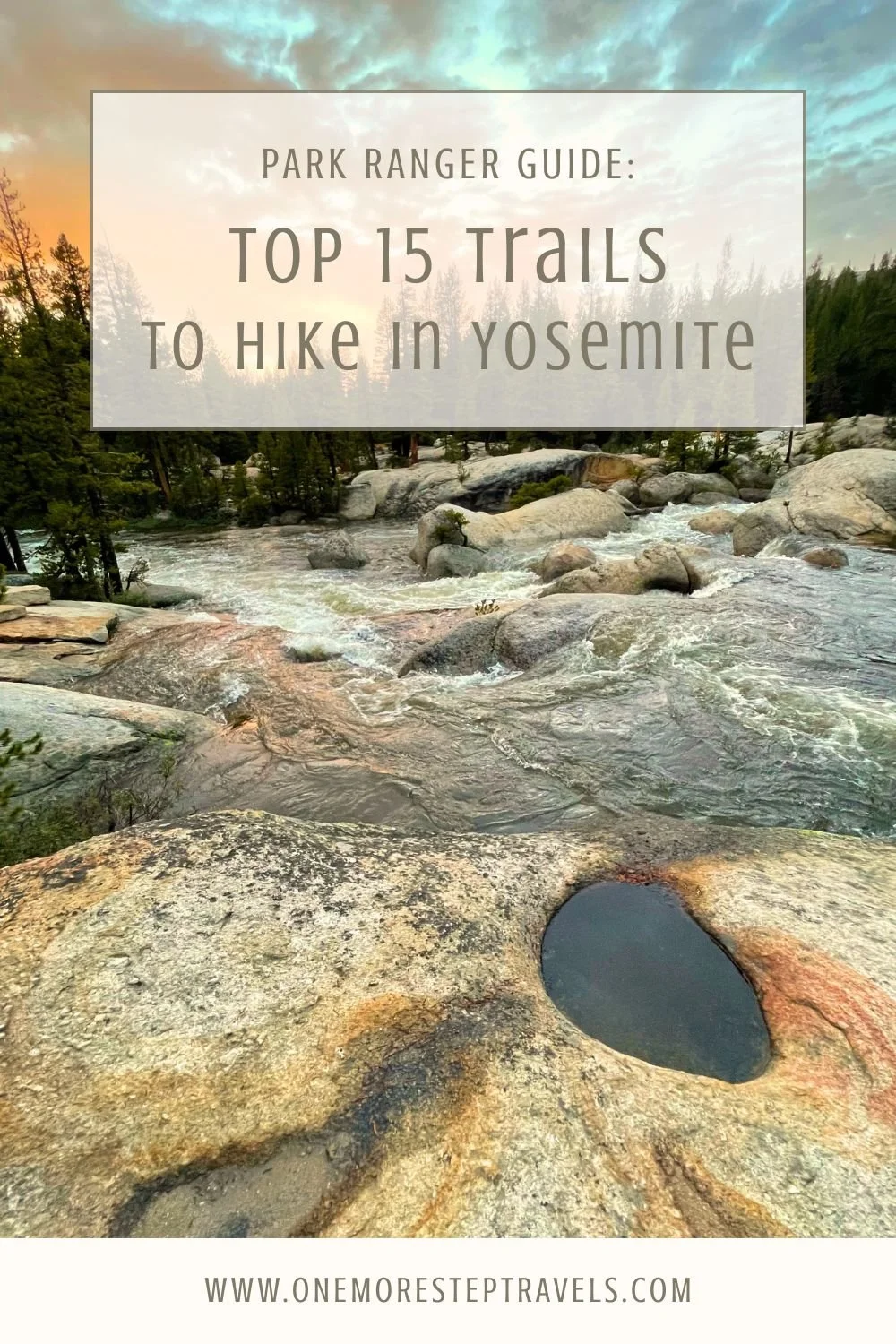
The 15 Best Day Hikes in Yosemite, According to a Park Ranger Who’s Hiked Them All
Disclosure: This post includes affiliate links and sponsored content for products and experiences that I actually do use, recommend, or think are worthwhile. I may earn a commission if you click through.
After working in Yosemite National Park for a season and spending 20 hours a week getting paid to hike, I have been able to hike pretty much all of the day hikes in the park. During those months of hiking throughout the park, certain trails out of the 800+ miles of trails really stood out. I’ve compiled a list of 15 hikes that I consider to be the some of the best.
Let me start by saying one thing: there are almost no “bad” hikes in Yosemite! It is a gorgeous park, from the valley to the peaks, and it contains many of my favorite day hikes I’ve ever been on. However, unlike park rangers who live at the park and have a lot of time to explore, most visitors only get a few days. And many visitors choose the trails that are mentioned again and again on social media and online reviews, not always seeing the best gems of the park.
This list is to help you get the most out of your time in Yosemite National Park. Don’t get caught up with what you “should” do or what’s most popular. The hikes on this list are my favorite because with each you get a lot of bang for your buck. The trails listed will lead you to sequoia trees, incredible views without too much effort, waterfalls, lakes, and peaceful forests—mostly away from the crowds.
For a complete picture on what to do in Yosemite, check out my guide for first timers, which covers the best time for visiting the park, the regions of the park, and activities to do beyond hiking.
Yosemite Hikes FAQ
How do I reserve a campsite near popular Yosemite trailheads for day hikes?
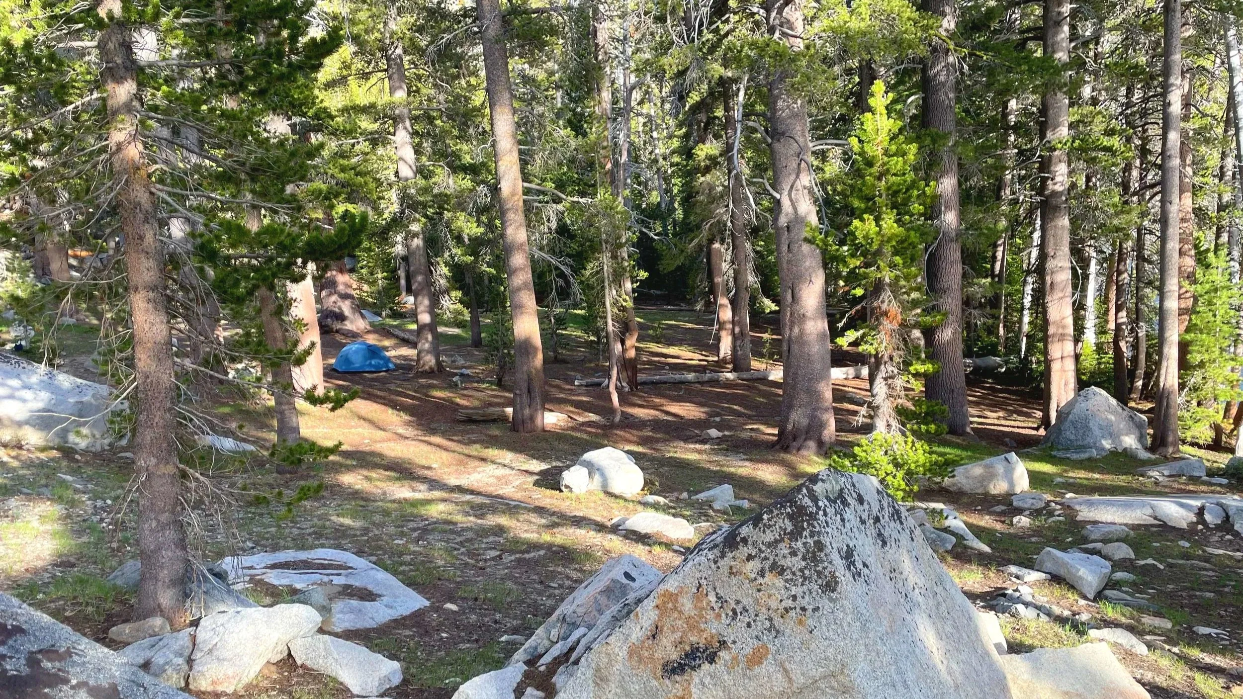
Visit the NPS website for a complete list of campsites in Yosemite and to reserve them. Popular campsites near Yosemite Valley hikes, such as Mist Trail and Half Dome, include Lower Pines, Upper Pines, and North Pines. They sell out very quickly, so plan to book them months in advance.
For hiking in the Tioga region, book a night at one of these campsites: Tuolumne Meadows, Porcupine Flat, White Wolf, and Yosemite Creek.
For backcountry hiking, including the High Sierra campsites along the Pacific Crest Trail, visit the NPS website for info about getting a wilderness permit.
How do I book shuttle services to Yosemite trailheads for day hikes?
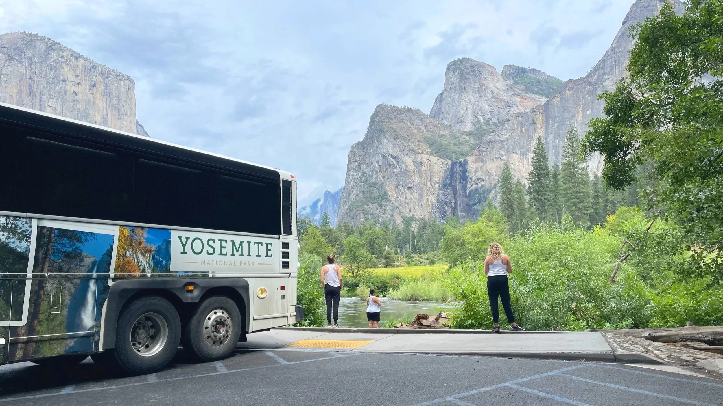
Within Yosemite Valley, there is a free shuttle during the summer that goes to all the major spots, including hiking trails in the valley. No reservations are required. The newsletter you get at the entrance should have the shuttle schedule on it.
If you are arriving to Yosemite without a car and would like to hike in Tuolumne Meadows, you can take the Meadows Hikers Bus run by a third party that operates within the park.
What are the top-rated guided hiking tours in Yosemite?
If you prefer to go on a guided hike in Yosemite, check out some of these top-rated tours.
Half Dome 4-Day Guided Tour - Pricey, but this is a guaranteed way to climb Half Dome if you can’t score a permit on your own, plus it includes meals, camping gear, and a guide for the whole route.
Customizable Private Hiking Tour - Get picked up from your hotel or lodging and go on whatever day hikes you want throughout the park with an expert guide. This could be a great option if you don’t want to drive all the way to Tuolumne Meadows yourself, but still want to see that part of the park.
Waterfalls of Yosemite - See a variety of Yosemite’s greatest waterfalls, from Yosemite Falls to Vernal and Nevada Fall, on this 8-hour customizable private hiking tour.
Yosemite Valley and Glacier Point - There is not a ton of hiking on this tour, but it will get you to sights throughout Yosemite Valley and Glacier Point, which sits above the valley.
What are the essential gear items for a multi-day backpacking trip in Yosemite?
This article will mainly cover the best day hikes in Yosemite, but if you’re looking to do a multi-day hike, every backpacker should be equipped with the Ten Essentials of Hiking, and in high altitudes you will especially want layers that will prepare you for weather changes.
Specific to Yosemite hikes, you will want to bring a bear canister, which is required for storing food and anything else smelly (i.e. chapstick, deodorant, toothpaste). You can rent the bear canisters at various locations throughout the park. This is highly regulated and the only approved method for storing food in the Yosemite backcountry.
Please note that bear spray is not the most effective tool to ward against bears in Yosemite, unlike other parks, and is actually illegal in California’s National Parks, so leave it home.
When is the best time to hike in Yosemite?
Hiking in Yosemite can be enjoyable during any season, but the spring and fall provide the best weather and fewest crowds.
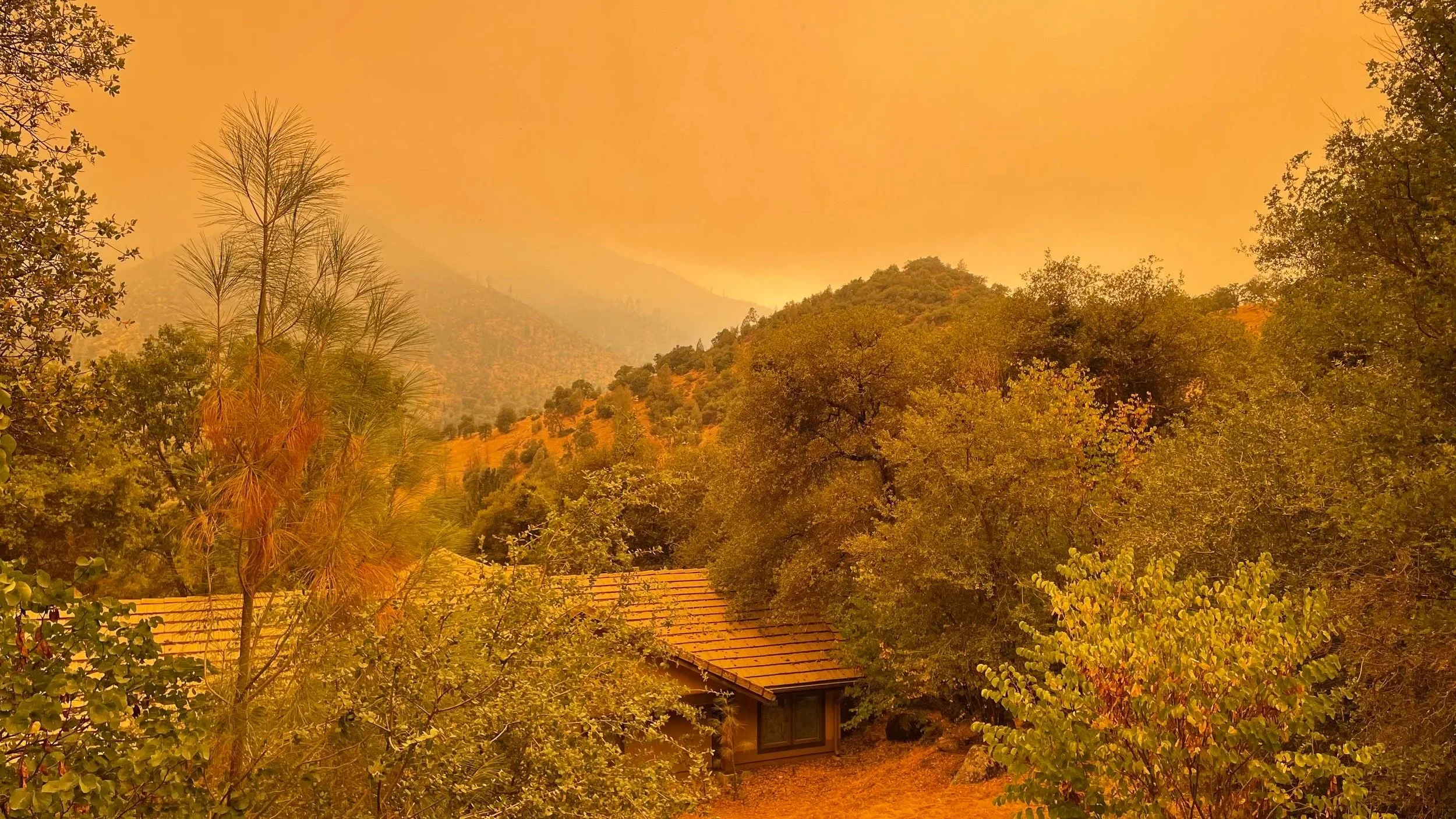
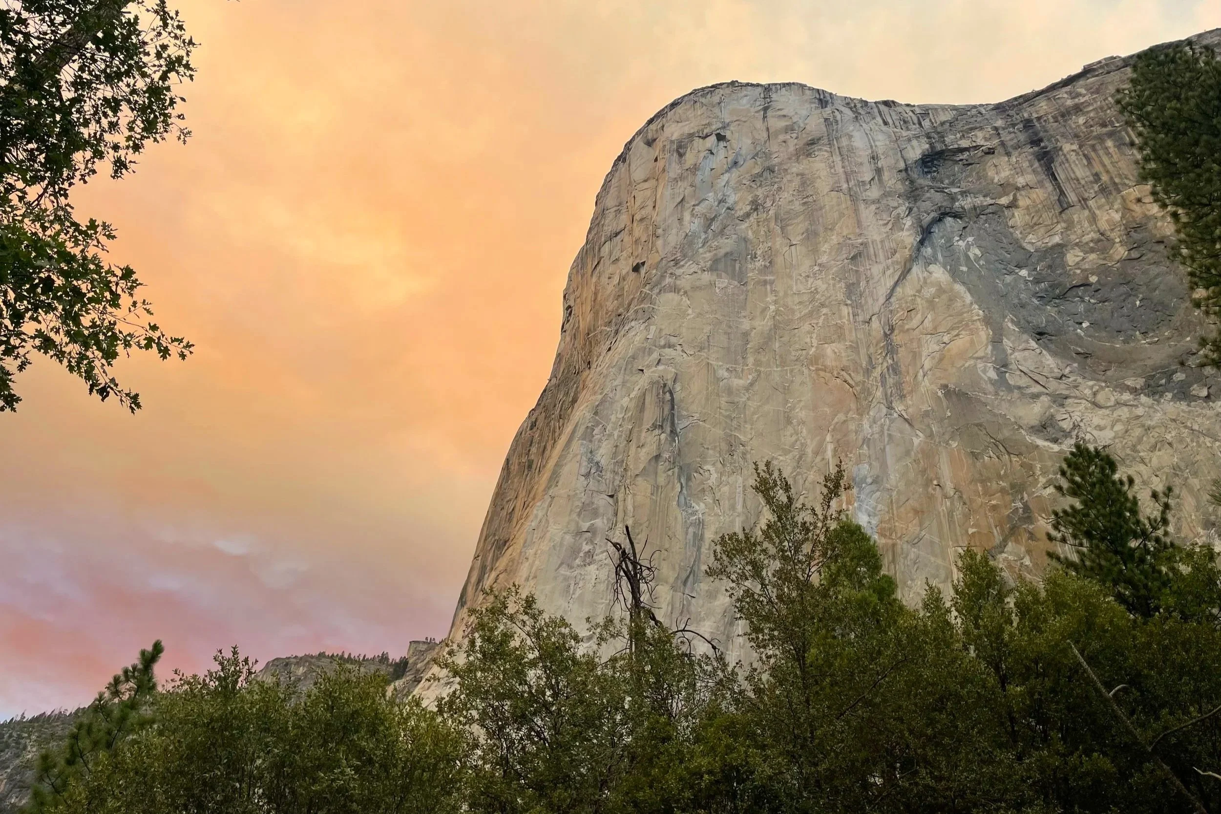
If you are visiting during the summer, get an early start to your day hike or wait until late afternoon to start—the intense summer sun can be brutal, especially in Yosemite Valley. You will also want to be aware of forest fires (pictured above) in or near the park and avoid hiking during poor air quality or in unsafe conditions.
If you are hiking in Yosemite during winter, be prepared to hike in snow and don’t expect any facilities to be open outside of Yosemite Valley. Day hiking will mostly be limited to Yosemite Valley, since road closures will make it impossible to park at certain trailheads, extending the length of many trails into multi-day hikes.
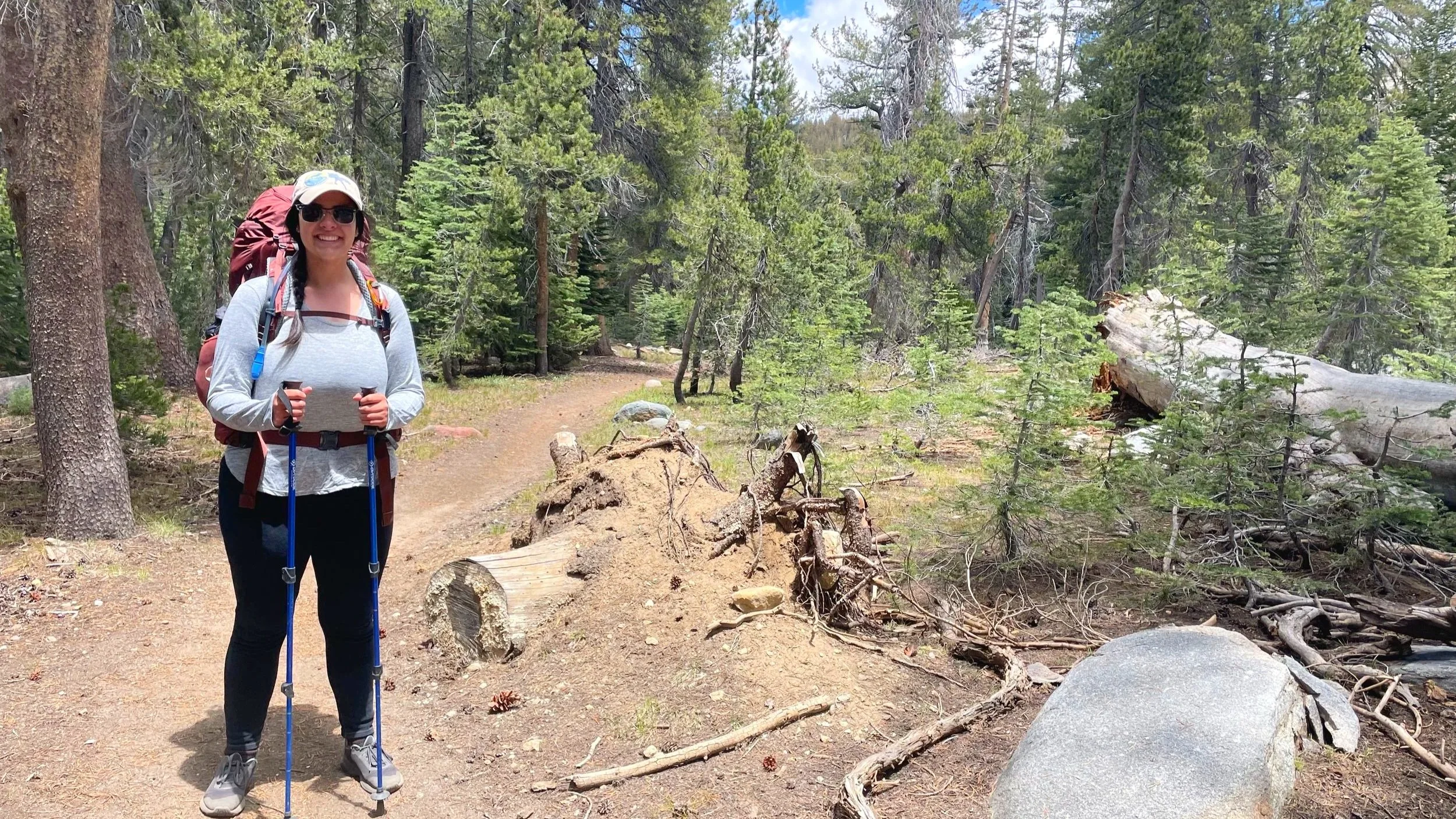
Are Yosemite hikes hard?
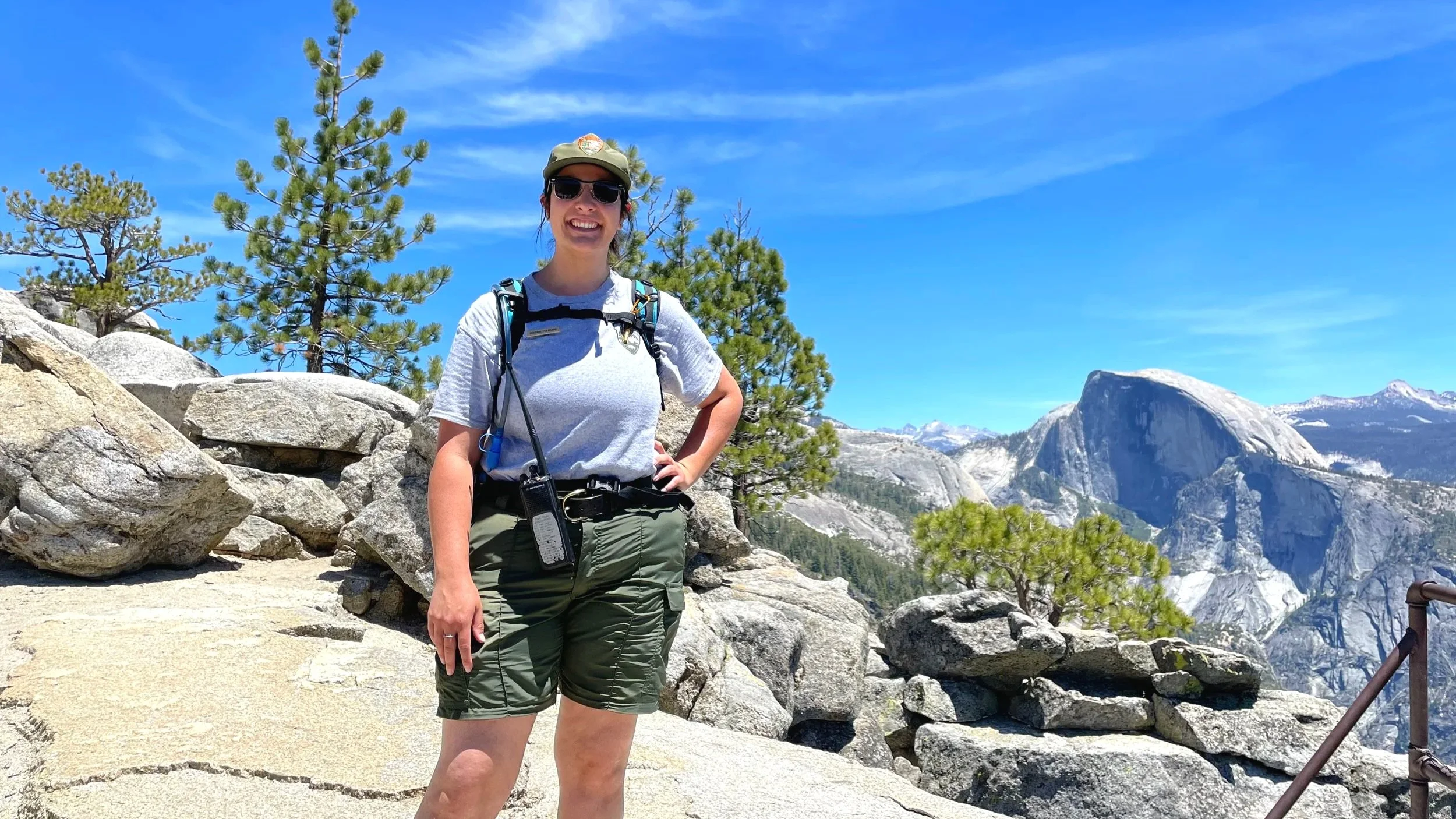
Me, after making it to the top of Yosemite Falls, pretending I’m not completely worn out because I’m in my park ranger uniform and everyone is watching me.
There are day hikes for every level in Yosemite! Many trails ascending out of Yosemite Valley, such as Upper Yosemite Falls and Four Mile Trail, are rather steep and have large granite steps, making them some of the hardest hikes in the area. Not all hikes are nearly that difficult though.
Each trail below has distance and elevation gain marked, as well as general difficulty level.
What is the hardest day hike in Yosemite?
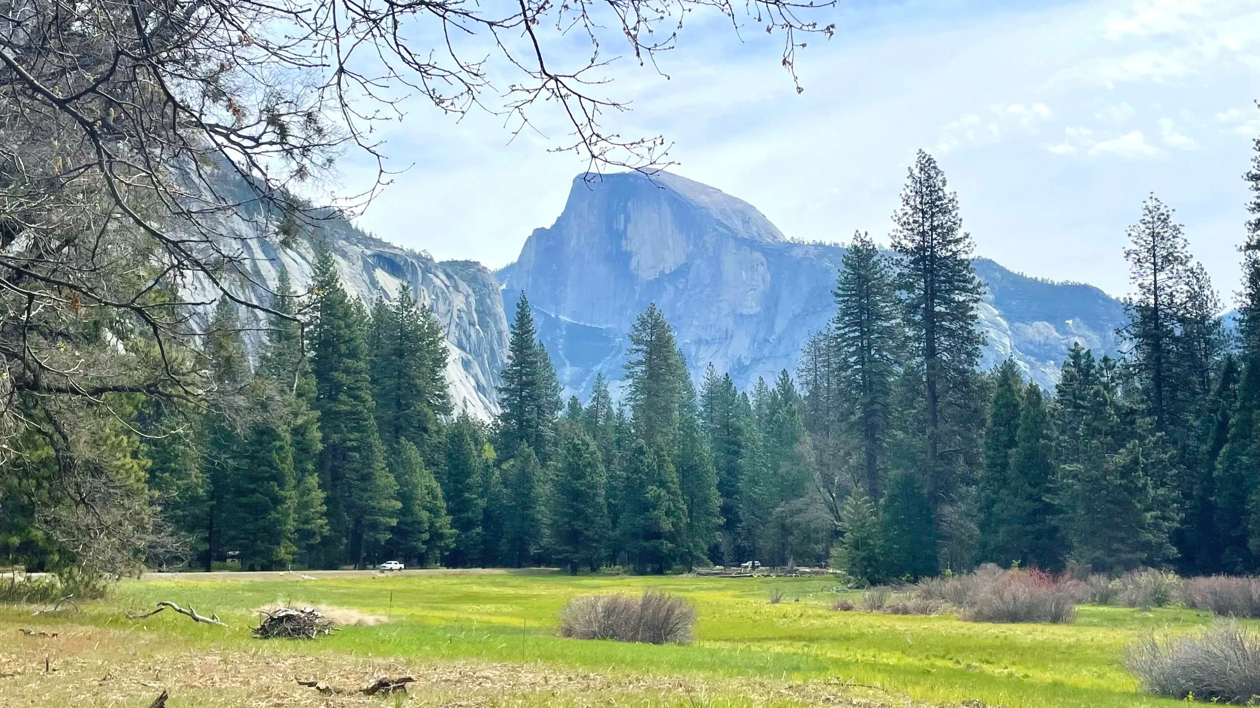
There are many challenging hikes in Yosemite, including hundreds of miles of backcountry trails. The most difficult front country trail is probably Half Dome, due to the technical nature of the cables, the length of the hike, and the elevation gain. More on hiking Half Dome below.
What are the easiest day hikes in Yosemite?
The flattest and easiest trails in Yosemite are in meadows, near the base of waterfalls in Yosemite Valley, and walks around lakes. Some notable ones include Cook’s Meadow, Tuolomne Meadows, Tenaya Lake, and Bridalveil Fall.
What is the most famous day hike in Yosemite?
There are many famous hikes in Yosemite, but perhaps the most famous is Mist Trail, which leads to two incredible waterfalls and is the start of the trail to Half Dome.
For that reason, it is also one of the most crowded hikes, any time of day and any time of year. Plan to take the Yosemite Valley shuttle in the summer to the trailhead as the parking lot fills up pretty early.
Yosemite Day Hikes Map
Best Day Hikes in Yosemite National Park
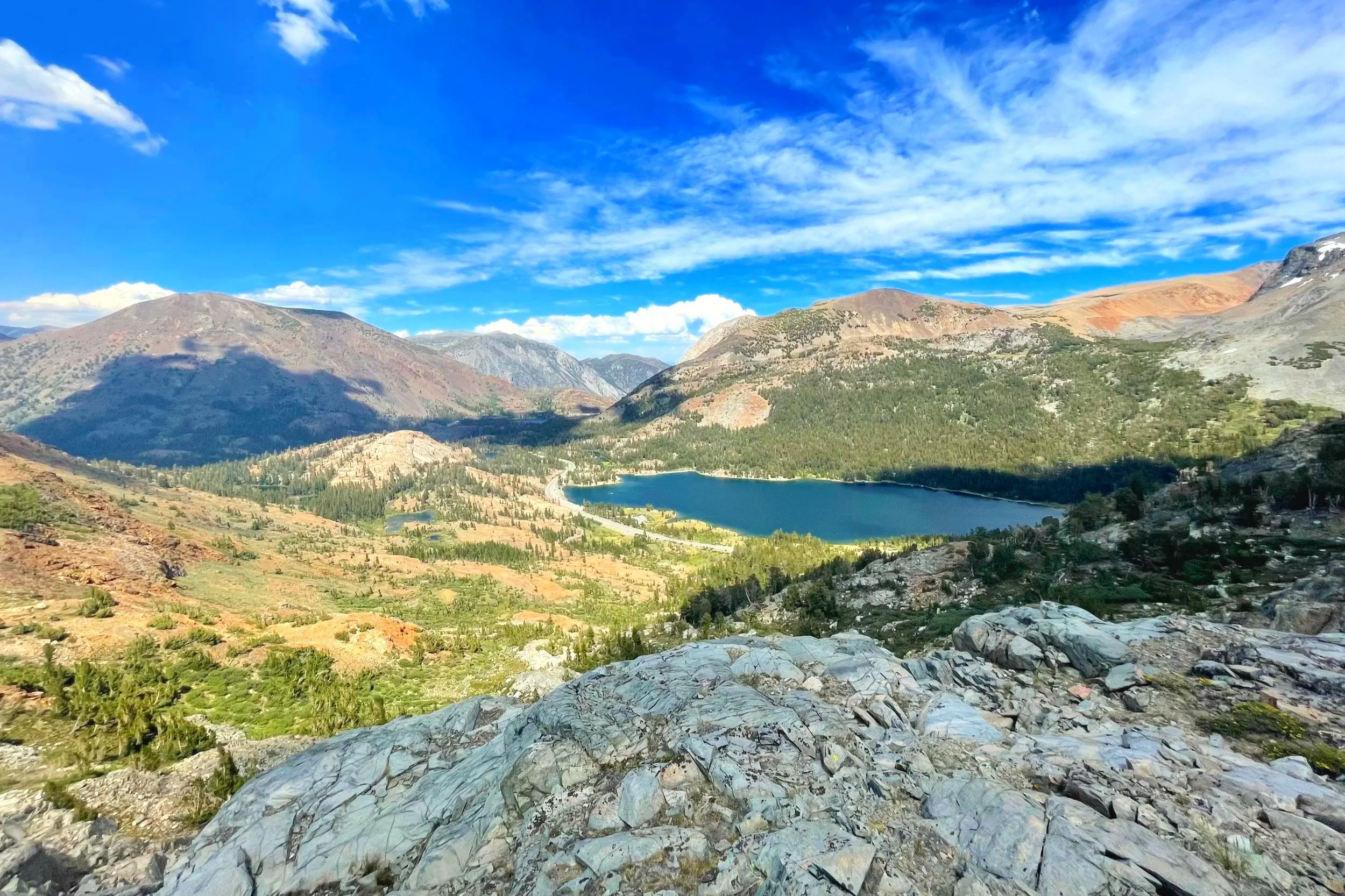
Top Trails along Tioga Road/Tuolumne Meadows
Gaylor Lakes
Difficulty level: Moderate
Distance: 2.6-4 miles
Elevation gain: 500ft
Trailhead: Just within the park near the Tioga Pass Entrance
Highlights: Alpine lakes and expansive views
Gaylor Lakes is at the top of my list because for a short hike, there is so much beauty packed in it! However, many people don’t know about it or go to it because it is at the very end of the park, on Tioga Road, which means you won’t have to share that beauty with hordes of other visitors.
After climbing a hill, you will get views of several lakes below, including Gaylor Lakes, which you can walk around. The trail also leads to even more hidden lakes and an old mine!
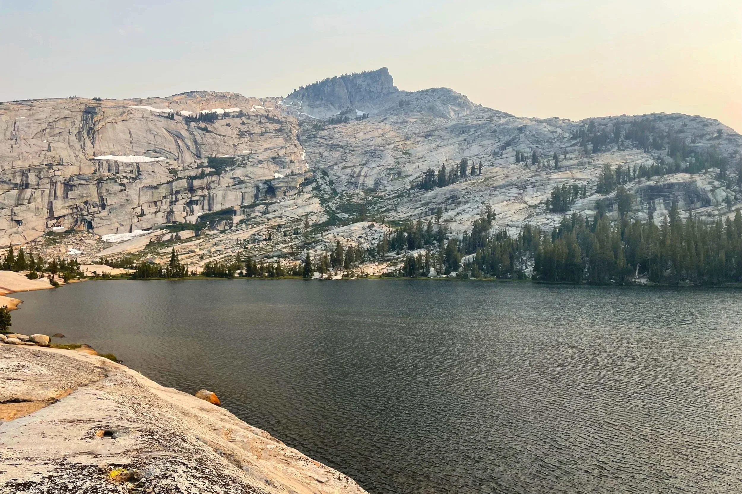
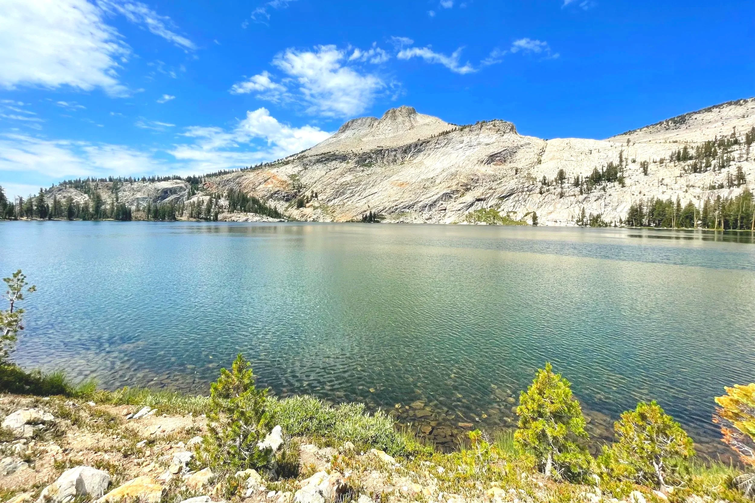
Cathedral Lakes
Difficulty level: Moderate to hard
Distance: 7.6 miles
Elevation gain: 1,000ft
Trailhead: Just west of the Tuolumne Meadows Visitor Center
Highlights: Several alpine lakes with mountain backdrops
Cathedral Lakes is a popular spot for backpackers, with several lakes that you can camp next to if you have a permit. It also makes a great day hike, with granite rock shores along several lakes in one trail, and unique peaks in the background, including Cathedral Peak. I couldn’t stop taking pictures when I was there!
I recommend hiking to both Upper and Lower Cathedral Lakes and staying for the sunset if you don’t mind hiking back at dusk.
Elizabeth Lake
Difficulty level: Moderate
Distance: 5-7 miles, depending on where you start
Elevation gain: Approx. 1,000ft
Trailhead: Either Tuolumne Meadows Visitor Center or Tuolumne Meadows Campground
Highlights: Quiet, scenic lake
There are clearly a lot of lakes along Tioga Road, and this one seems to be one of the least crowded, often getting overlooked by nearby Cathedral Lakes. I only saw a handful of other people there when I hiked to it, but with the reopening of Tuolumne Meadows Campground in 2025, that may change.
The hike involves a steady climb through forest and, though the lake is small, it is a very beautiful spot for a picnic. In the early summer, you can spot many small wildflowers along the path.
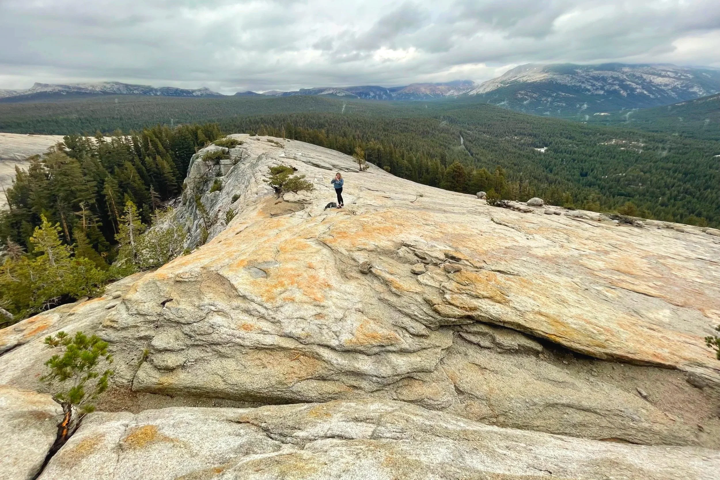
Dog Lake/Lembert Dome
Difficulty level: Moderate
Distance: 3.8-5 miles, depending on the route
Elevation gain: 800ft
Trailhead: Halfway down the Tuolumne Meadows Lodge road, past the ranger station
Highlights: Scenic views on top of a dome
This trail is more like two in one: one path leading to Dog Lake, with a spur trail leading up Lembert Dome. You can either start this trail near Tuolumne Meadows at the Lembert Dome Picnic Area or my preferred route at the Lembert Dome parking lot near the Tuolumne Meadows Wilderness Center.
Most of the elevation gain on this trail comes at the end when going up the rocky Lembert Dome, but that is the most exhilarating part and shouldn’t be missed. The views at the top are beautiful and vast!
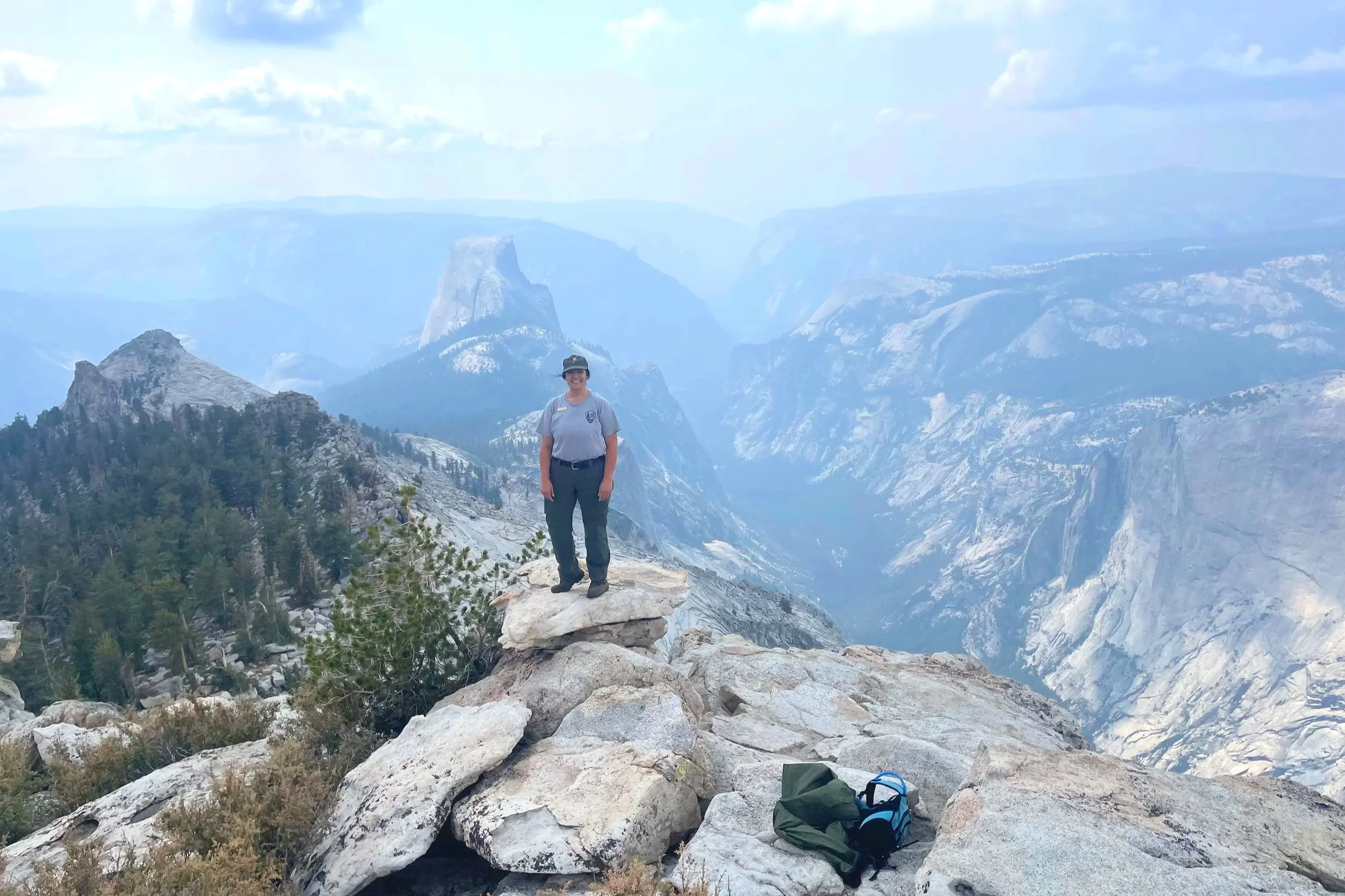
Clouds Rest
Difficulty level: Hard
Distance: 14 miles
Elevation gain: 2,300ft
Trailhead: The southwest end of Tenaya Lake, at Sunrise Lakes Trailhead
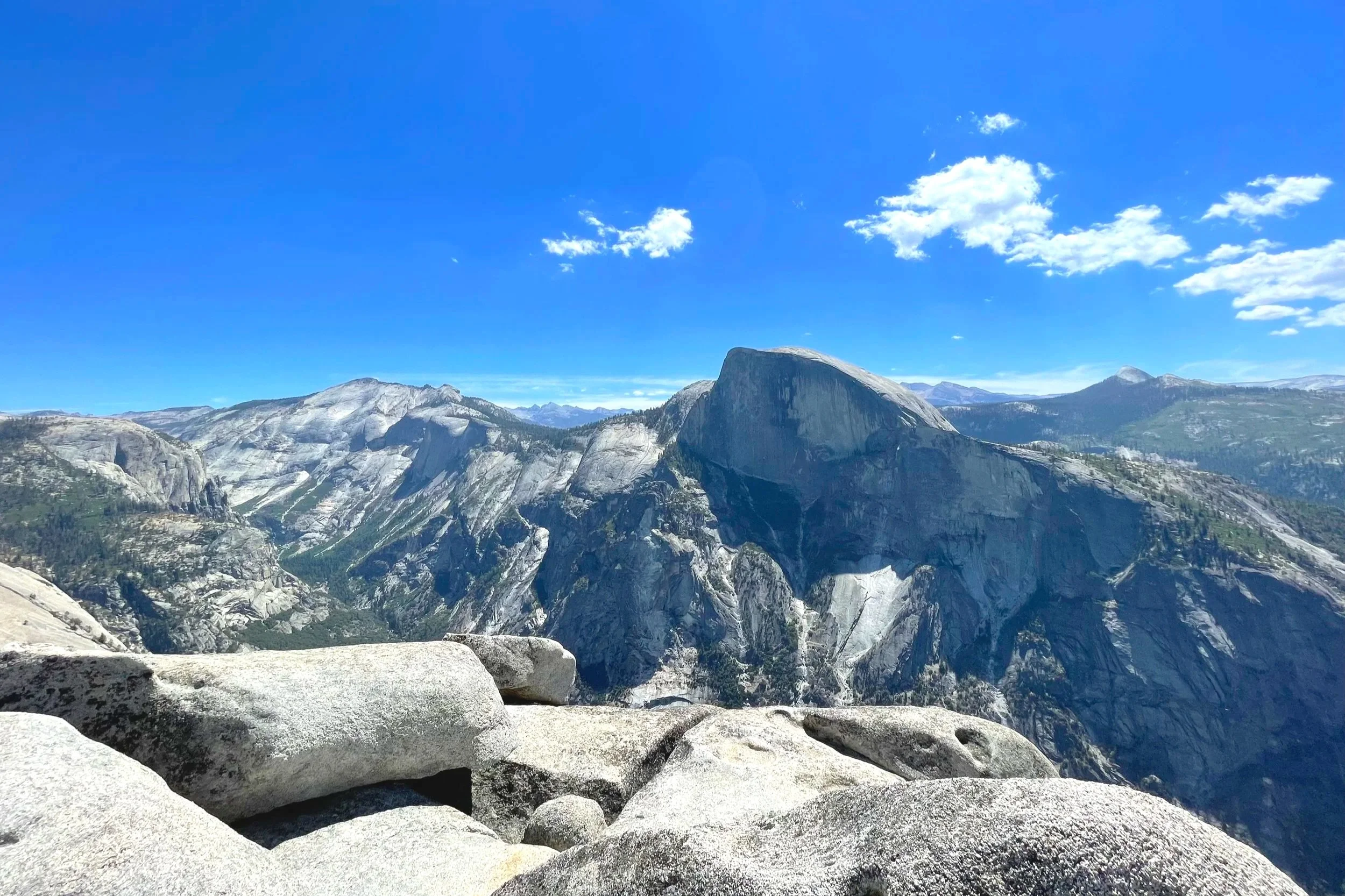
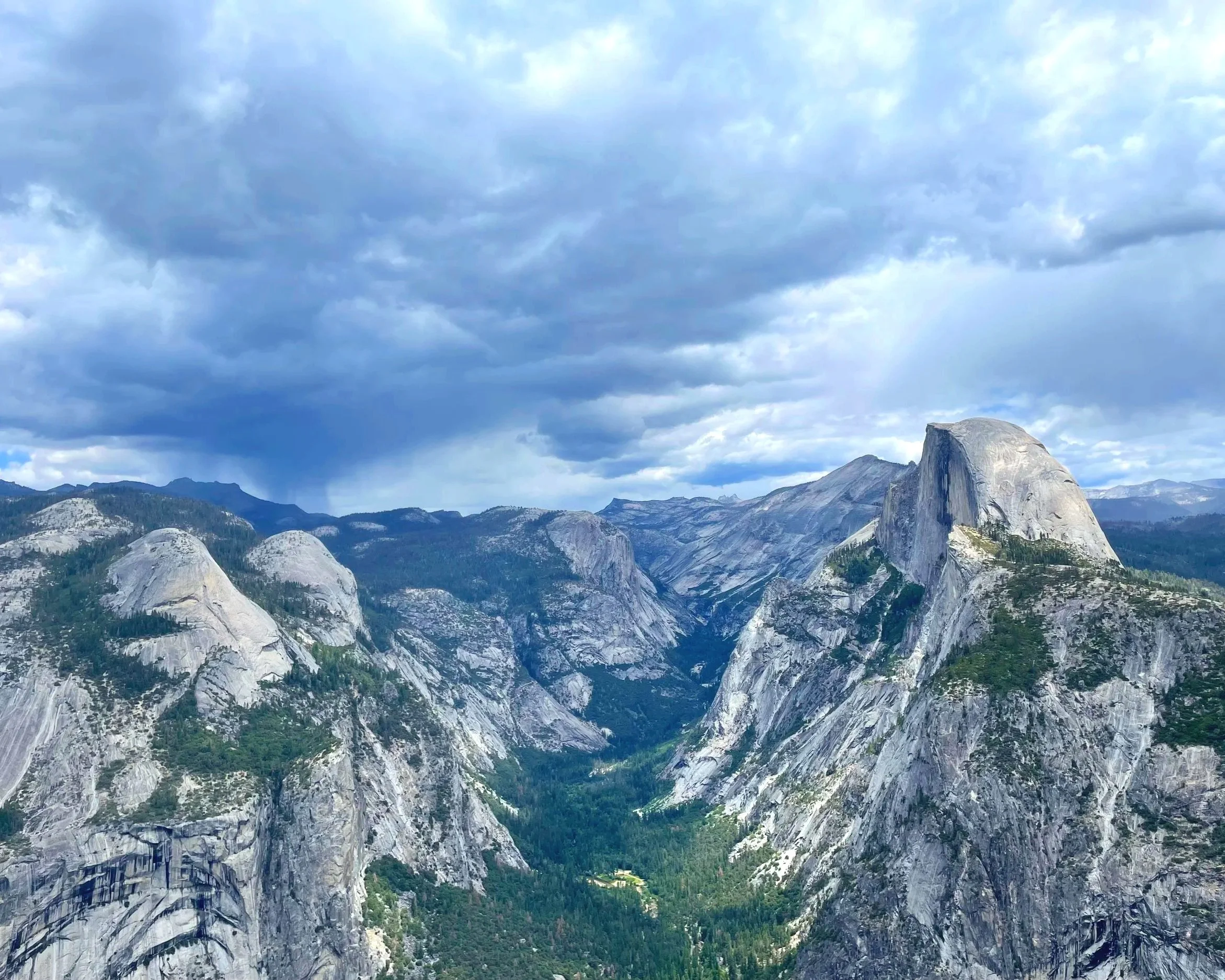
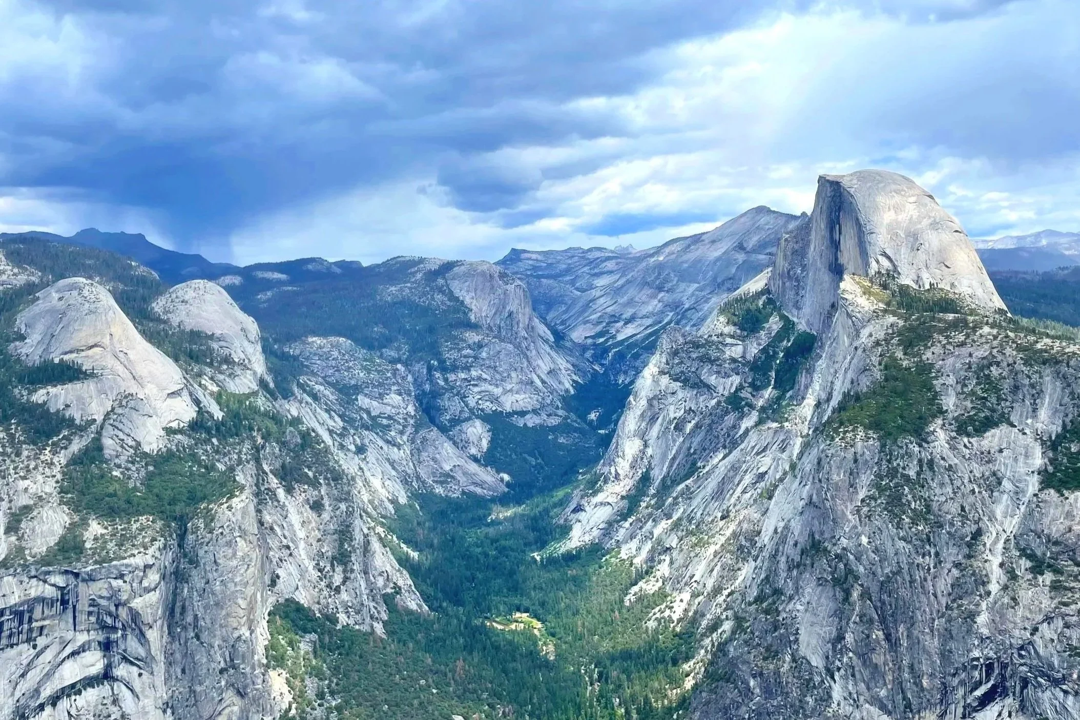
Highlights: 360 degree views at the top, including the back of Half Dome and Yosemite Valley
If you want views of the backside of Half Dome, this is one of the best places to get them. Clouds Rest takes you very high into the sky and might just be my favorite view in Yosemite. Unfortunately, I’m not the only one who feels that way. Clouds Rest is a very popular trail, especially for people who were unable to get permits to climb Half Dome, or even some people who get permits for Half Dome and decided to hike from Clouds Rest, instead of from the Mist Trail.
This hike involves a lot of steady climbing up switchbacks and is rather long. When I hiked it, there was also a rainstorm while coming down, which made the steep trail slick and muddy. However, the views were worth the pain!
Ten Lakes
Difficulty level: Hard
Distance: 12.6 miles
Elevation gain: 2,200ft
Trailhead: Along Tioga Road, about ten miles west of Olmstead Point
Highlights: Backcountry camping near many lakes
My first ever overnight backpacking trip was to Ten Lakes, so it has a special place in my heart. It’s a beautiful area with lots of lakes, scenic views, meadows, and forests. In late spring, there were tons of wildflowers and a few marmots.
This trail is best for backpackers or those looking for an all day hike. The parking areas for the trail are shared with several other backcountry routes, so try to get there as early as possible.
Glen Aulin
Difficulty level: Moderate to hard
Distance: 12.6 miles
Elevation gain: 750ft
Trailhead: Tuolumne Meadows, past Soda Springs
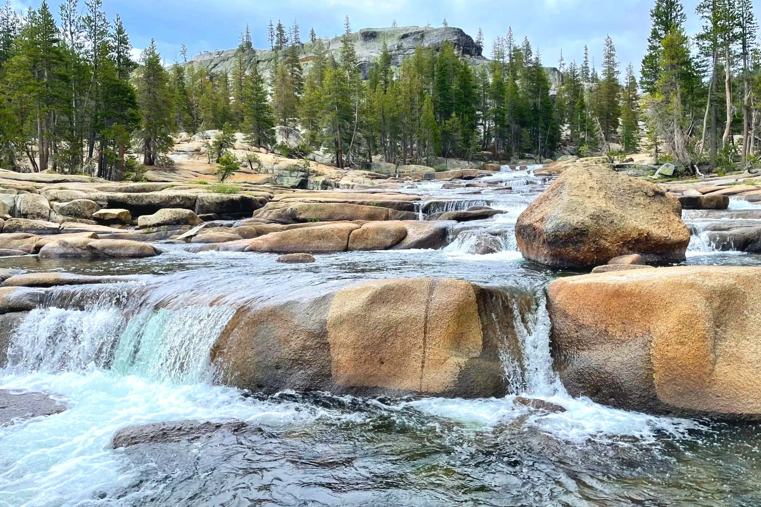
Highlights: Hiking on granite boulders to cascades
The terrain on this hike starts in a normal forest, but before long takes you to granite faces that you will walk along until you reach the first cascades. Continuing on leads to even more cascades and backcountry campgrounds. This trail is along the Pacific Crest Trail and can be a fun area to meet thru hikers.
Glen Aulin is a really neat hike, with beautiful water features, just don’t be caught on the exposed rock in a storm!
Lyell Canyon to Twin Bridges
Difficulty level: Easy
Distance: 1-11.4 miles
Elevation gain: 300ft
Trailhead: Same as Lembert Dome parking lot
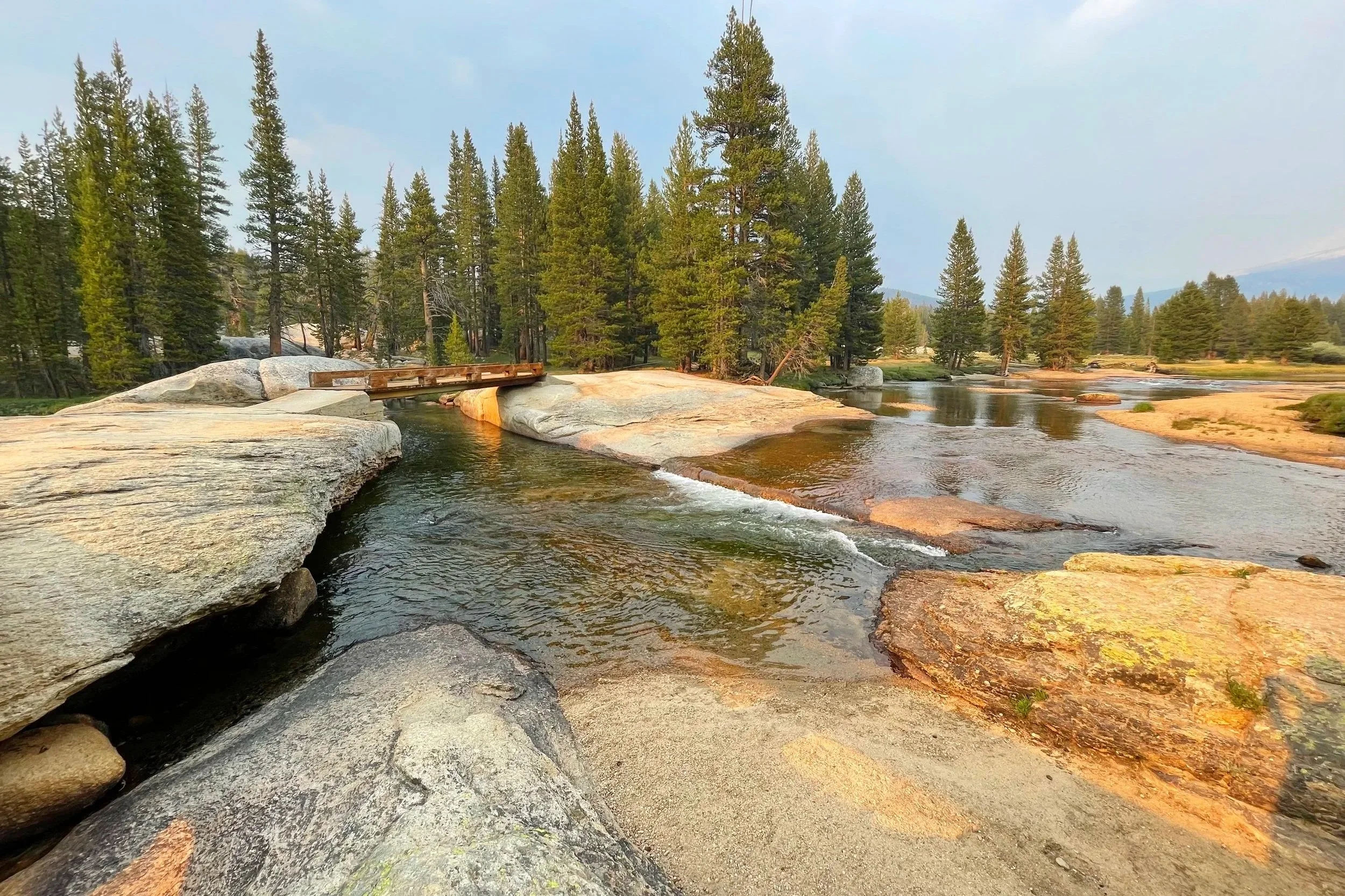
Highlights: Very flat trail with wildlife viewing and beautiful rivers
This trail goes on for a while, but is a flat and easy path to follow along meadows and the edge of the forest. I’ve seen marmots, bucks, and more along this trail.
If you are short on time or energy, just walk to the twin bridges (less than a mile from the trailhead) and enjoy the beautiful flowing water. It is an especially incredible sight when the sun is setting and casts pinks and yellows on the water.
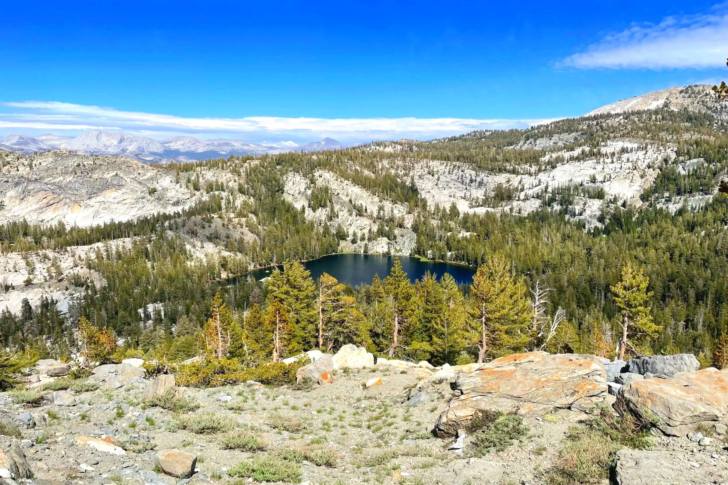
North Dome via Porcupine Creek
Difficulty level: Moderate
Distance: 10.4 miles
Elevation gain: 580ft
Trailhead: Porcupine Creek Trailhead, 4.5 miles west of Olmstead Point
Highlights: Views of Yosemite Valley after a fairly flat trail
For stunning views of Yosemite Valley without a steep trail or too many crowds, this hike is a great option. I did pass a large group of running high schoolers, but I also experienced complete solitude where my only companion in the forest was a deer eating a mushroom.
The end of the trail travels along a dome that you will actually descend into to get really great views of Yosemite Valley. The only steep part of the hike is coming back up from the dome. Add a short detour and visit Indian Rock—a picture-perfect hole in a rock and a granite arch—while you’re there.

Best Hiking Trails in Yosemite Valley
Mist Trail to Vernal Fall & Nevada Fall
Difficulty level: Moderate to hard
Distance: 1.6-5.4 miles
Elevation gain: Up to 2,000ft
Trailhead: Happy Isles Shuttle Stop
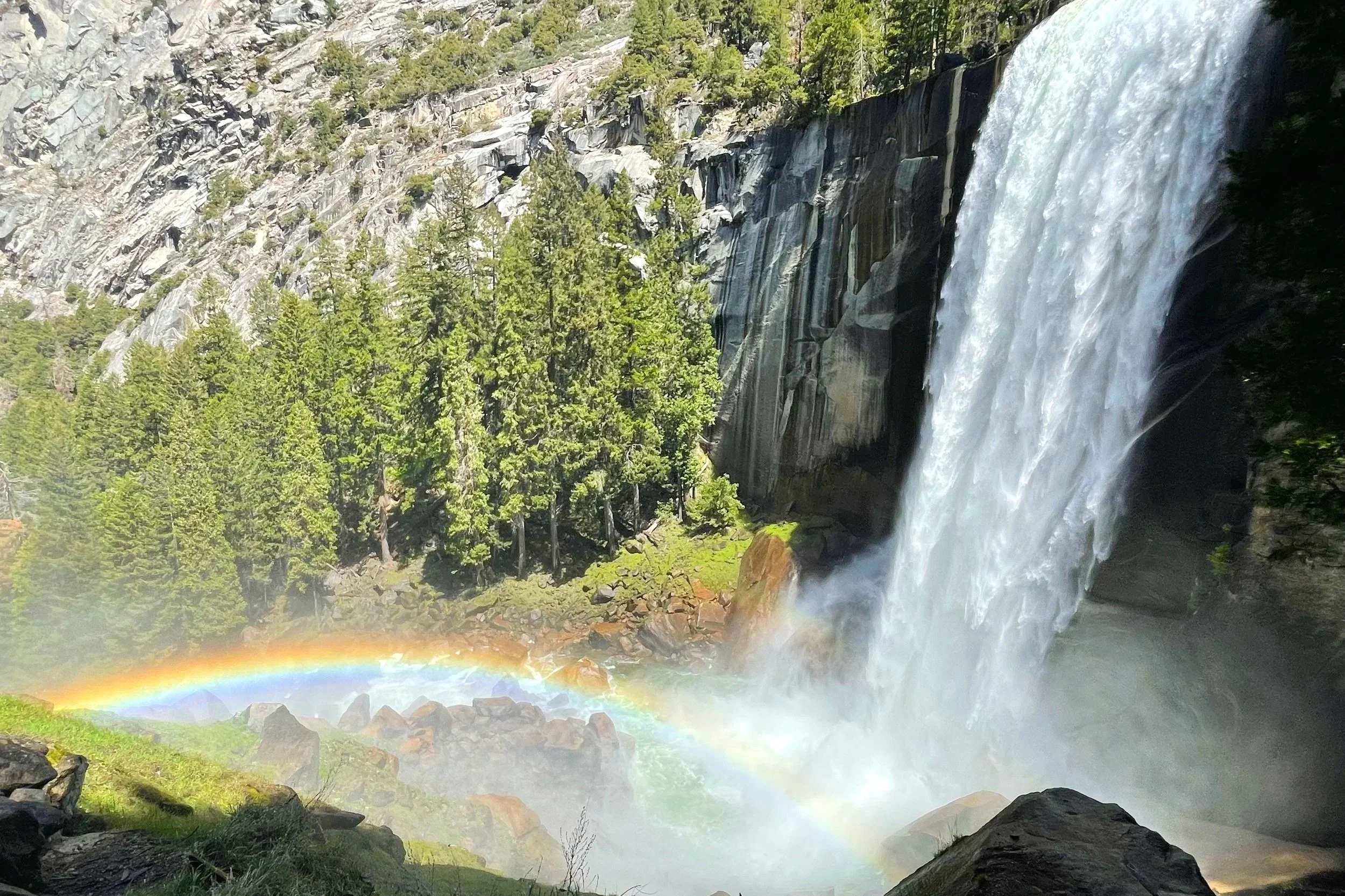
Highlights: Two gorgeous waterfalls
Vernal Fall is one of the most scenic waterfalls in Yosemite, making Mist Trail one of the most popular trails in the park. I have been many times and always feel it is worth it, but be prepared to see a lot of other people on the trail.
For how popular this trail is, it’s actually not an easy one. There is a steady climb and then at the falls, the steps are often wet, uneven, and steep. If you continue on to Nevada Fall, there is little shade and even more steep climbing, but the second waterfall is also very beautiful.
From the top of Nevada Fall, you can either come down the way you came, or travel along the John Muir Trail to get back to the start.
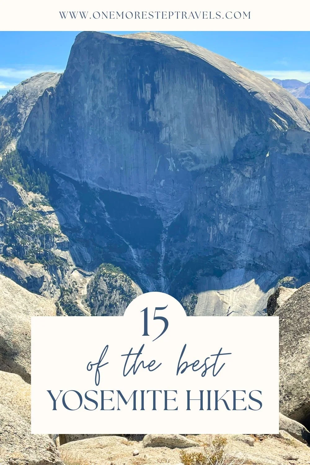
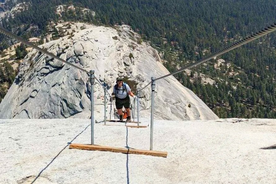
Half Dome
Difficulty level: Hard
Distance: 14-16 miles
Elevation gain: 4800ft
Trailhead: Happy Isles Shuttle Stop or Yosemite Valley Trailhead Parking (if arriving very early in the morning)
Highlights: Climb cables to reach the top of an iconic dome
The beginning of this trail is the same as the route to Vernal Fall/Nevada Fall. Once you continue past the falls, there is still quite a bit of hiking left, including the iconic cables up a steep cliff face. Be sure to stop at the river and refill your water—you’ll need it!
The rest of the hike meanders through a nice forest until you reach the cables, which are completely exposed to the elements and unsafe to travel on during wet or stormy conditions. The top of Half Dome provides stunning views which are well-earned! Enjoy the views as you build up energy for the long way back, including descending the cables, which can often be more nerve-wracking than climbing them.
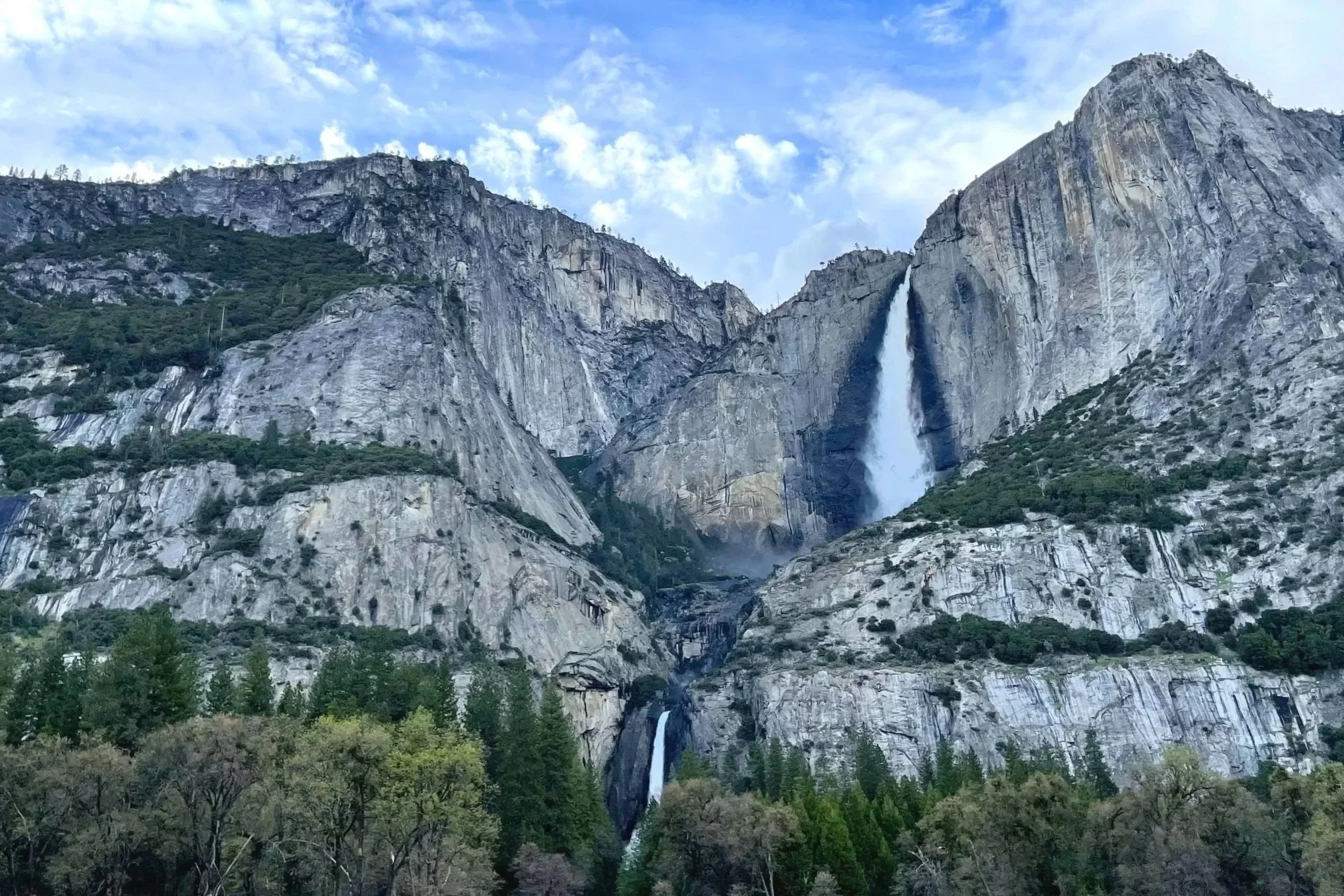
Lower Yosemite Falls & Cook’s Meadow
Difficulty level: Easy
Distance: 2 miles
Elevation gain: 50ft
Trailhead: Lower Yosemite Falls Shuttle Stop or any of the parking lots in Yosemite Village
Highlights: Views of waterfalls and surrounding cliffs
This is probably the most crowded and the easiest trail on this list. Technically two different trails, both are very short and right across the road from each other, so most people combine them.
Situated near the Yosemite Exploration Center and Theater, the easy flat path leads to some of the most iconic views in Yosemite Valley: Lower Yosemite Fall and a meadow surrounded by granite cliffs. It is a great way to acclimate to the park as a first timer. See my guide for first timers to Yosemite for more information on visiting the park.
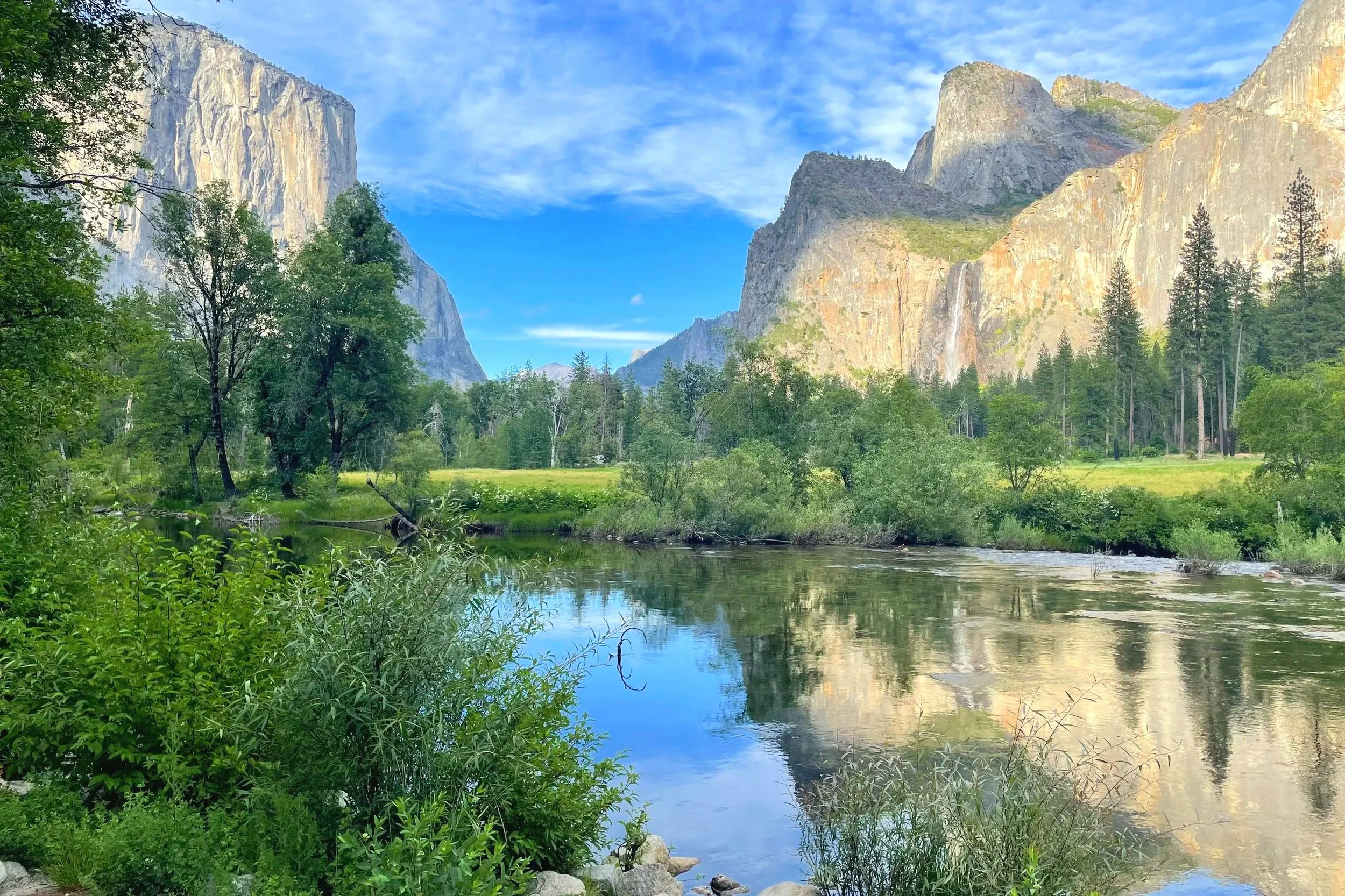
El Capitan Wall & Meadow
Difficulty level: Easy
Distance: 1-2 miles
Elevation gain: Less than 200ft
Trailhead: Side of the road by El Capitan Meadow or at the parking lot just before the meadow and across the street
Highlights: See El Capitan, the famous climbing wall, up close
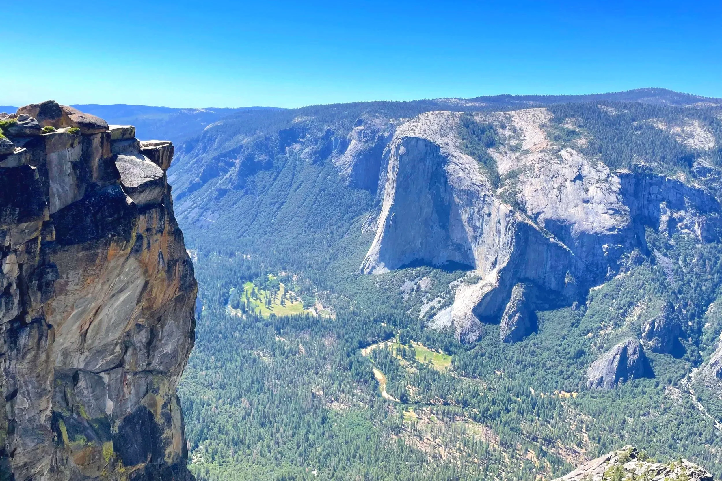
El Capitan, a large cliff that sticks out in Yosemite Valley, is one of the most iconic sights in the park. It draws climbers from all over the world who are looking for a challenge, and was made even more famous by Alex Hannold, a daring climber who climbed it free solo—without ropes.
At any time of day during the summer, climbers may be seen along the 3,000-foot wall. It is a really neat experience to walk in the meadow beneath the cliff and look up at the climbers. What many people don’t know is that anyone can walk directly up to the wall itself. Just follow the windy trail that climbers take to see how their climbs truly begin.
Other Incredible Hiking Trails in Yosemite
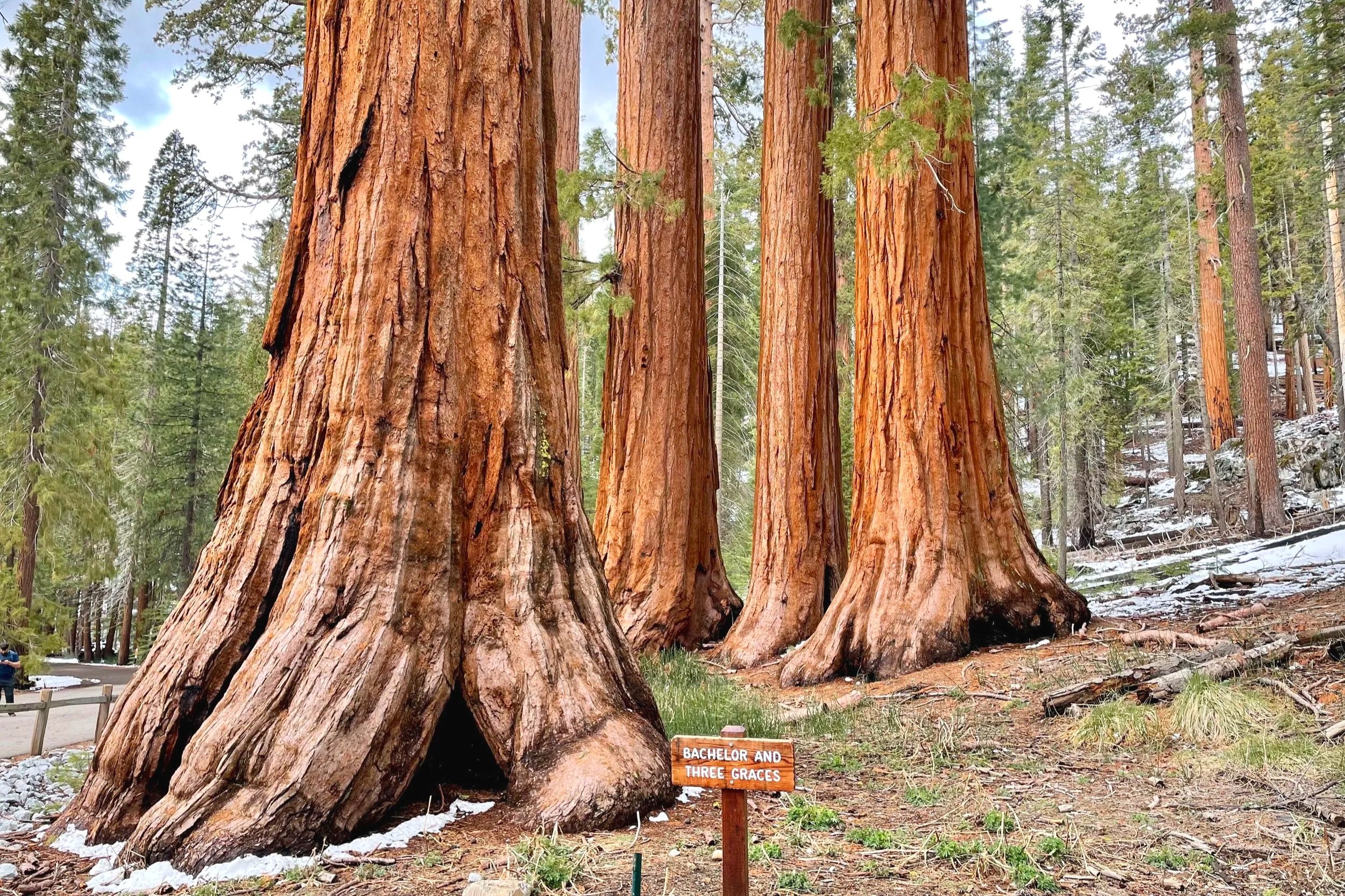
Mariposa Grove
Difficulty level: Easy to moderate
Distance: 0.3-7.75 miles
Elevation gain: Up to 1,200ft
Trailhead: Mariposa Grove Welcome Plaza (free shuttle from there or walking an extra 4 miles during winter)
Highlights: Giant sequoia trees
Mariposa Grove is the most impressive sequoia grove in Yosemite National Park. There are dozens of sequoia trees in giant red clusters. It feels otherworldly to walk between them, under them, and even over some the fallen ones (just don’t cross any fences or leave the trail).
For a more secluded experience, continue walking beyond the Big Trees Loop and even past Grizzly Giant, and go all the way to Wawona Point. Very few people wander that far, but there are many more giant trees back there and a great view of the valley below at the end. Just be aware of the shuttle times so you don’t miss the last one. If you do, you will need to walk all the way back to the parking lot, adding about two miles.
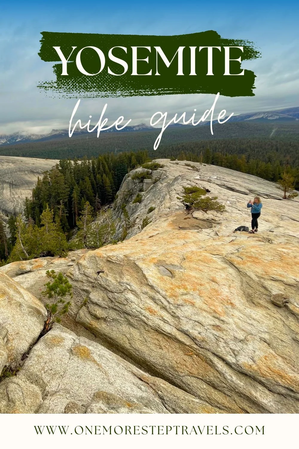
Sentinel Dome/Taft Point
Difficulty level: Easy to moderate
Distance: 5 miles
Elevation gain: Approx. 600ft
Trailhead: Along Glacier Road, about 2.5 miles before Glacier Point
Highlights: Climbing a dome, views of Yosemite Valley
On Glacier Road, before you get to Glacier Point, one of the best hikes in the park involves a dome and the top of a cliff. If you learned about Yosemite on Instagram or Tiktok, you have very likely seen pictures and videos of Taft Point. It is a very scenic location to enjoy views of the valley below. Sunset or sunrise here is magical!
Final Thoughts on the Best Day Hikes in Yosemite
Wondering where other hikes are that you’ve probably heard about, such as the top of Yosemite Falls or Four Mile Trail? While those trails do lead to stunning views of Yosemite Valley, they are steep, unshaded, and not very enjoyable. They aren’t even close to my favorite, so they didn’t make this list of top 15 best day hikes in Yosemite.
The trails listed above are worth the effort and great for first timers to Yosemite National Park who are looking for scenic views, waterfalls, and sights you can’t get anywhere else. Be sure to check out my guide for first timers to Yosemite that covers lodging, the major regions of the park, and getting around the park.
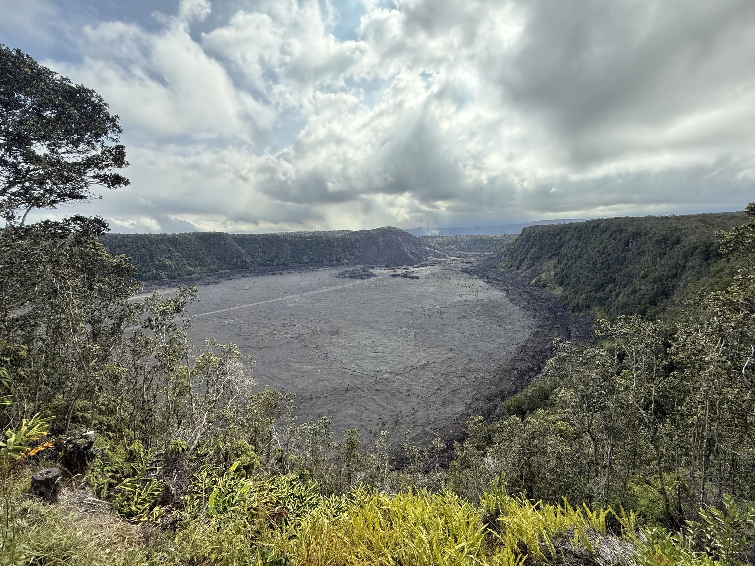
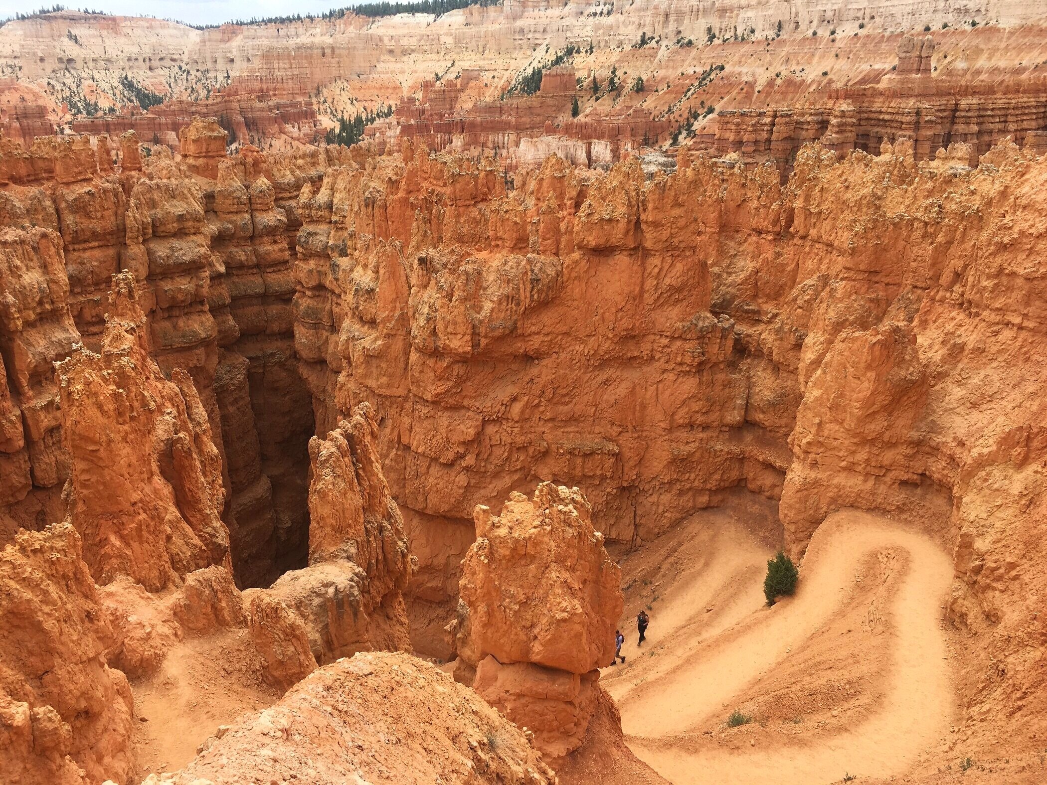
Looking for other national park guides? Check out my Southern Utah national park road trip, my camping guide for the Smoky Mountains, or my road trip around Big Island, including Hawaii Volcanoes.
Love hiking as much as I do? Take a 52-hike challenge, where you hike 52 hikes in one year!